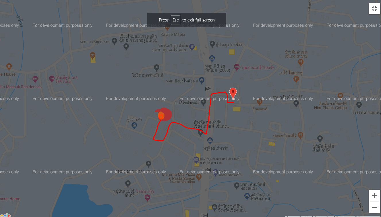
 |
|
function initMap() {
var directionsService = new google.maps.DirectionsService;
var directionsDisplay = new google.maps.DirectionsRenderer;
navigator.geolocation.getCurrentPosition(function(position) {
var posNow = {lat: position.coords.latitude,lng: position.coords.longitude};
<?php foreach ($round as $key => $round) { ?>
var maps;
maps = new google.maps.Map(document.getElementById('map<?php echo $round; ?>'), {
center: {lat: <?php echo $lat[$key]; ?>, lng: <?php echo $lng[$key]; ?>},
zoom: 18,
});
var marker = new google.maps.Marker({
position: {lat: <?php echo $lat[$key]; ?>, lng: <?php echo $lng[$key]; ?>},
map:maps,
});
<?php } ?>
});//end navi
}

อยากให้แสดงระยะทางของตำแหน่งปัจจุบัน กับ lat lng ที่ผม get จาก db มาอะครับ
ผม console.log ดู ค่าตำแหน่งปัจจุบันก็มาพร้อมแล้วครับ
แต่
var directionsService = new google.maps.DirectionsService;
var directionsDisplay = new google.maps.DirectionsRenderer;
2ตัวนี้ผมลองไปใช้แล้วมันไม่ทำงานอะครับ
และก็ถ้าจะคำนวณว่ากี่กิโลได้ด้วยจะดีมากครับ ขอบคุณครับ
Tag : PHP, MySQL, JavaScript, CodeIgniter, XAMPP
|
|
|
 |
 |
 |
 |
| Date :
2020-01-05 00:07:22 |
By :
boss3075027 |
View :
1726 |
Reply :
1 |
|
 |
 |
 |
 |
|
|
|
|
 |